Maps
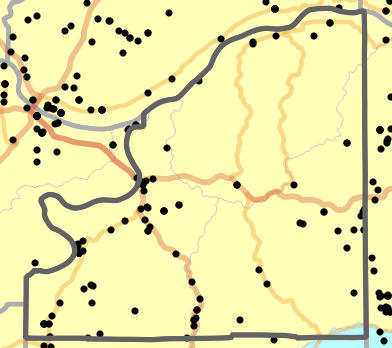
Landmark Map
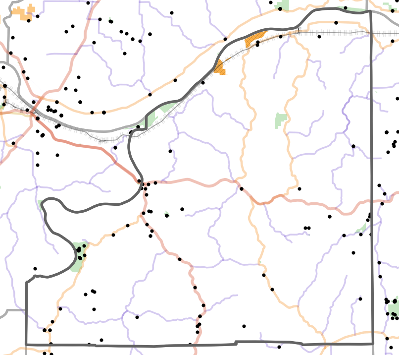
Landmark locality map for Osage County, Missouri
Map created 15 April 2026.
 | Interstate Highway |  | Railroad |  | US Army Corps of Engineers |
 | US Highway |  | Department of Conservation |  | US Fish and Wildlife Service |
 | State Highway |  | Department of Natural Resources |  | National Park Service |
 | County Highway |  | US Forest Service |  | US Department of Defense |
Locator Map
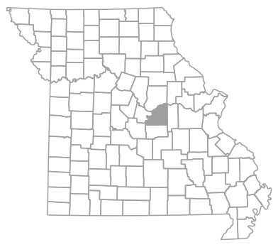
Locator map for Osage County, Missouri
Map created 15 April 2026.
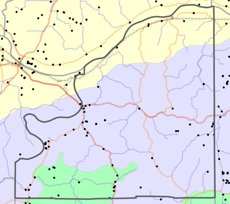
Natural Divisions Locality Map
Natural Divisions locality map for Osage County, Missouri
Map created 15 April 2026.
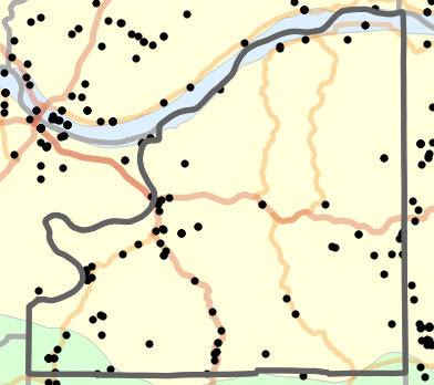
Ecological Drainage Unit Locality Map
Ecological Drainage Units locality map for Osage County, Missouri
Map created 15 April 2026.
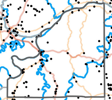
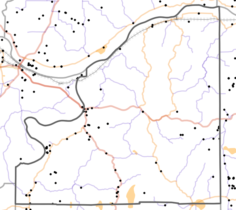
Major Watersheds Locality Map
Major Watersheds locality map for Osage County, Missouri
Map created 15 April 2026.
Major Rivers Locality Map
Major Rivers locality map for Osage County, Missouri
Map created 15 April 2026.
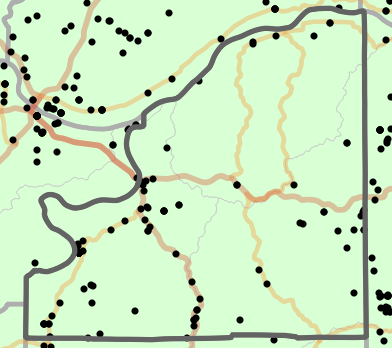
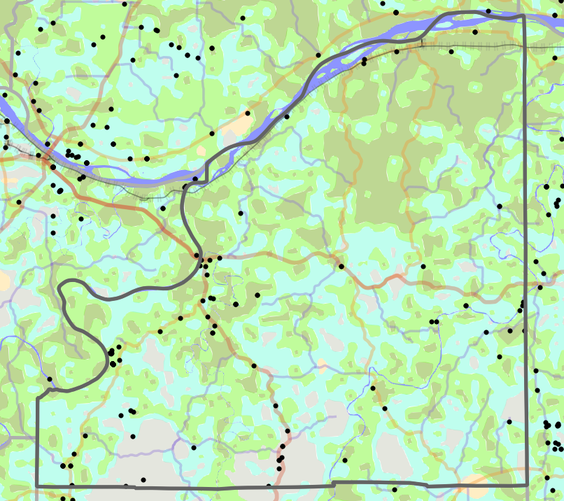
Level I Ecoregion Locality Map
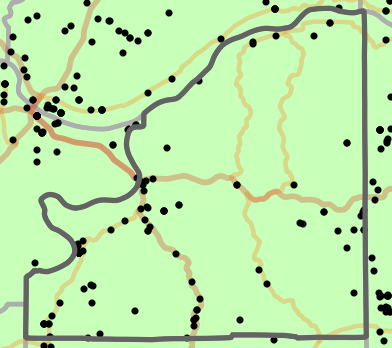
Level I Ecoregion locality map for Osage County, Missouri
Map created 15 April 2026.
Level II Ecoregion Locality Map
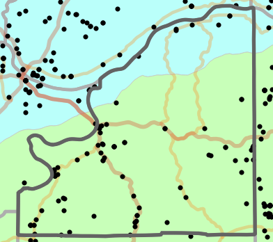
Level II Ecoregion locality map for Osage County, Missouri
Map created 15 April 2026.
Level III Ecoregion Locality Map

Level III Ecoregion locality map for Osage County, Missouri
Map created 15 April 2026.
Level IV Ecoregion Locality Map
Level IV Ecoregion locality map for Osage County, Missouri
Map created 15 April 2026.
Presettlement Prairie Locality Map
Presettlement Prairie locality map for Osage County, Missouri
Map created 15 April 2026.
Historical Vegetation Map
Historical Vegetation map for Osage County, Missouri
Map created 15 April 2026.
 | Water |  | Prairie |  | Barrens / Scrub |
 | Forest |  | Woodland |  | Open Woodland |
Geology Locality Map
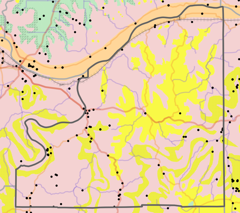
Geology locality map for Osage County, Missouri
Map created 15 April 2026.
 | Alluvium |  | Sandstone |  | Dolomite |  | Limestone |
 | Clay |  | Sandstone / Limestone |  | Dolomite / Limestone |  | Limestone / Sandstone |
 | Igneous |  | Sandstone / Dolomite |  | Dolomite / Shale |  | Limestone / Shale |
 | Limestone / Sandstone / Shale |
Species List
Salamanders (Caudata)
- Cryptobranchus alleganiensis (Sonnini de Manoncourt and Latreille, 1801) - Hellbender
- Ambystoma maculatum (Shaw, 1802) - Spotted Salamander
- Ambystoma opacum (Gravenhorst, 1807) - Marbled Salamander
- Ambystoma texanum (Matthes, 1855) - Small-mouthed Salamander
- Notophthalmus viridescens (Rafinesque, 1820) - Central Newt
- Necturus maculosus (Rafinesque, 1818) - Mudpuppy
- Plethodon albagula Grobman, 1944 - Western Slimy Salamander
- Plethodon serratus Grobman, 1944 - Southern Red-backed Salamander
Frogs (Anura)
- Spea bombifrons (Cope, 1863) - Plains Spadefoot
- Anaxyrus americanus (Holbrook, 1836) - American Toad
- Anaxyrus fowleri (Hinckley, 1882) - Fowler's Toad
- Acris blanchardi Harper, 1947 - Blanchard's Cricket Frog
- Dryophytes versicolor (LeConte, 1825) - Gray Treefrog
- Pseudacris crucifer (Wied-Neuwied, 1838) - Spring Peeper
- Lithobates catesbeianus (Shaw, 1802) - North American Bullfrog
- Lithobates clamitans (Latreille in Sonnini de Manoncourt and Latreille, 1801) - North American Green Frog
- Lithobates palustris (LeConte, 1825) - Pickerel Frog
- Lithobates sphenocephalus (Cope, 1886) - Coastal Plains Leopard Frog
- Gastrophryne carolinensis (Holbrook, 1835) - Eastern Narrow-mouthed Toad
Lizards (Squamata, "Lizards")
- Crotaphytus collaris (Say in James, 1822) - Eastern Collared Lizard
- Sceloporus consobrinus Baird and Girard, 1853 - Prairie Lizard
- Aspidoscelis sexlineatus (Linnaeus, 1766) - Prairie Racerunner
- Plestiodon anthracinus (Baird, 1850) - Southern Coal Skink
- Plestiodon fasciatus (Linnaeus, 1758) - Common Five-lined Skink
- Plestiodon laticeps (Schneider, 1801) - Broad-headed Skink
- Scincella lateralis (Say in James, 1822) - Little Brown Skink
- Ophisaurus attenuatus Baird in Cope, 1880 - Western Slender Glass Lizard
Snakes (Squamata, "Snakes")
- Coluber constrictor Linnaeus, 1758 - North American Racer
- Lampropeltis calligaster (Harlan, 1827) - Prairie Kingsnake
- Lampropeltis holbrooki Stejneger, 1902 - Speckled Kingsnake
- Lampropeltis triangulum (Lacépède, 1789) - Eastern Milksnake
- Masticophis flagellum (Shaw, 1802) - Eastern Coachwhip
- Opheodrys aestivus (Linnaeus, 1766) - Northern Rough Greensnake
- Pantherophis emoryi (Baird and Girard, 1853) - Great Plains Ratsnake
- Pantherophis obsoletus (Say in James, 1822) - Western Ratsnake
- Tantilla gracilis Baird and Girard, 1853 - Flat-headed Snake
- Carphophis vermis (Kennicott, 1859) - Western Wormsnake
- Diadophis punctatus (Linnaeus, 1766) - Ring-necked Snake
- Heterodon platirhinos Palisot de Beauvois in Sonnini de Manoncourt and Latreille, 1801 - Eastern Hog-nosed Snake
- Nerodia sipedon (Linnaeus, 1758) - Common Watersnake
- Storeria dekayi (Holbrook, 1839) - DeKay's Brownsnake
- Storeria occipitomaculata (Storer, 1839) - Red-bellied Snake
- Thamnophis proximus (Say in James, 1822) - Orange-striped Ribbonsnake
- Thamnophis sirtalis (Linnaeus, 1758) - Common Gartersnake
- Virginia striatula (Linnaeus, 1766) - Rough Earthsnake
- Virginia valeriae Baird and Girard, 1853 - Western Smooth Earthsnake
- Agkistrodon contortrix (Linnaeus, 1766) - Eastern Copperhead
- Crotalus horridus Linnaeus, 1758 - Timber Rattlesnake
Turtles (Testudines)
- Chelydra serpentina (Linnaeus, 1758) - North American Snapping Turtle
- Sternotherus odoratus (Latreille in Sonnini and Latreille, 1801) - Eastern Musk Turtle
- Chrysemys picta (Schneider, 1783) - Western Painted Turtle
- Graptemys geographica (LeSueur, 1817) - Northern Map Turtle
- Graptemys ouachitensis Cagle, 1953 - Ouachita Map Turtle
- Pseudemys concinna (LeConte, 1830) - Eastern River Cooter
- Terrapene triunguis (Agassiz, 1857) - Three-toed Box Turtle
- Trachemys scripta (Thunberg in Schoepff, 1792) - Red-eared Slider
- Apalone mutica (LeSueur, 1827) - Midland Smooth Softshell
- Apalone spinifera (LeSueur, 1827) - Northern Spiny Softshell
Collection Summary
Osage County has a total of 170 valid, non-duplicated collections representing 58 species and 76 localities. There are a total of 49 collectors and 79 collection dates for the county. This results in a total of 85 expeditions for the county, a measure of unique date / collector(s) combinations. The county's earliest collection year is 1934 and its most recent collection year is 2024. The earliest and latest collection dates (independent of earliest and most recent collection years) are January 5 and October 21, respectively. If you have a new record to report for Osage County, read the New Records section of the FAQ.
Collection Summary by Species

Potential Species Records
| Likelihood | Species | Common Name | Rationale | Ecoregion / Watershed | |
|---|---|---|---|---|---|
 | 2 | Anaxyrus cognatus | Great Plains Toad | Same Level IV ecoregion, within 5 miles | River Hills |
| 2 | Anaxyrus woodhousii | Rocky Mountain Toad | Same Level IV ecoregion, within 5 miles | Osage/Gasconade Hills |
| 2 | Eurycea longicauda | Long-tailed Salamander | Same Level IV ecoregion, within 5 miles | Osage/Gasconade Hills |
| 2 | Eurycea lucifuga | Cave Salamander | Same Level IV ecoregion, within 5 miles | Osage/Gasconade Hills |
| 2 | Gastrophryne olivacea | Western Narrow-mouthed Toad | Same Level IV ecoregion, within 5 miles | River Hills |
| 2 | Graptemys pseudogeographica | False Map Turtle | Same watershed, within 5 miles | Lower Gasconade |
| 2 | Graptemys pseudogeographica | False Map Turtle | Same watershed, within 5 miles | Lower Missouri-Moreau |
| 2 | Macrochelys temminckii | Western Alligator Snapping Turtle | Same watershed, within 5 miles | Lower Missouri-Moreau |
| 2 | Pseudacris maculata | Boreal Chorus Frog | Same Level IV ecoregion, within 5 miles | River Hills |
| 4 | Ambystoma annulatum | Ringed Salamander | Same Level IV ecoregion, within 10 miles | Central Plateau |
| 4 | Lithobates blairi | Plains Leopard Frog | Same Level IV ecoregion, within 10 miles | River Hills |
| 4 | Terrapene ornata | Ornate Box Turtle | Same Level IV ecoregion, within 10 miles | River Hills |
| 4 | Tropidoclonion lineatum | Lined Snake | Same Level IV ecoregion, within 10 miles | Osage/Gasconade Hills |
 | 6 | Agkistrodon piscivorus | Northern Cottonmouth | Same watershed, within 20 miles | Lower Osage |
| 6 | Cemophora coccinea | Northern Scarletsnake | Same Level IV ecoregion, within 20 miles | Central Plateau |
| 6 | Eurycea nerea | Northern Grotto Salamander | Same Level IV ecoregion, within 20 miles | Osage/Gasconade Hills |
| 6 | Hemidactylium scutatum | Four-toed Salamander | Same Level IV ecoregion, within 20 miles | River Hills |
| 6 | Lithobates areolatus | Northern Crawfish Frog | Same Level IV ecoregion, within 20 miles | River Hills |
| 6 | Lithobates sylvaticus | Wood Frog | Same Level IV ecoregion, within 20 miles | River Hills |
 | 8 | Ambystoma tigrinum | Eastern Tiger Salamander | Same Level IV ecoregion, within 30 miles | Central Plateau |
| 8 | Dryophytes chrysoscelis | Cope's Gray Treefrog | Same Level IV ecoregion, within 30 miles | River Hills |
| 8 | Eurycea tynerensis | Oklahoma Salamander | Same Level IV ecoregion, within 30 miles | Osage/Gasconade Hills |
| 10 | Opheodrys vernalis | Smooth Greensnake | Same Level IV ecoregion, adjacent county | River Hills |
| 10 | Thamnophis radix | Plains Gartersnake | Same Level IV ecoregion, adjacent county | River Hills |
Checklist
All MOHAP publications are released in portable document format (PDF), an ISO standard. You must download and install a reader (click icon below) to view these documents. A state checklist, including all counties, is available on the publications page.

 Daniel, R.E., B.S. Edmond, and J.T. Briggler. 2026. Checklist of Osage County Missouri Amphibians and Reptiles for 2025. <http://atlas.moherp.org/county/Osage>
- Daniel, R.E., B.S. Edmond, and J.T. Briggler. 2026. Checklist of Osage County Missouri Amphibians and Reptiles for 2025. <http://atlas.moherp.org/county/Osage> (with common names)