Maps
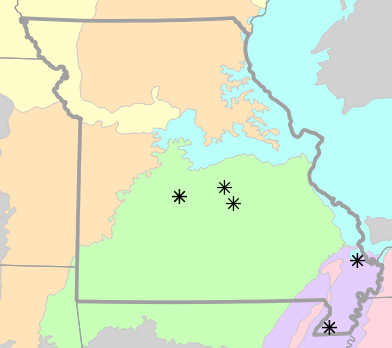
Locality Map
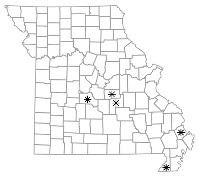
Locality map for Cemophora coccinea (Northern Scarletsnake).
Map created 3 August 2022.
County Map
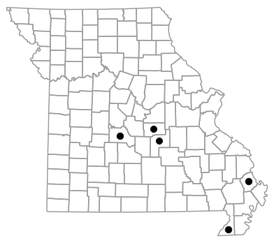
County map for Cemophora coccinea (Northern Scarletsnake).
Map created 3 August 2022.
Historical Locality Map
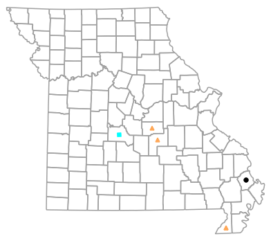
Historical locality map for Cemophora coccinea (Northern Scarletsnake). Black circles (  ) represent records after 1986, blue squares (
  ) represent records between 1966 and 1986, orange triangles (
  ) represent records prior to 1966. Note that more recent records might conceal underlying older records.
Map created 3 August 2022.
Historical County Map

Historical county map for Cemophora coccinea (Northern Scarletsnake). Black circles ( ) represent records after 1986, blue squares ( ) represent records between 1966 and 1986, orange triangles ( ) represent records prior to 1966. Note that only the most recent county record for each county is shown.
Map created 3 August 2022.
Ecological Drainage Locality Map

Ecological Drainage Units locality map for Cemophora coccinea (Northern Scarletsnake).
Map created 3 August 2022.
Natural Divisions Locality Map

Natural Divisions and Sections locality map for Cemophora coccinea (Northern Scarletsnake).
Map created 3 August 2022.
Major Watersheds Locality Map

Major Watersheds locality map for Cemophora coccinea (Northern Scarletsnake).
Map created 3 August 2022.
Level I Ecoregion Locality Map
Level I Ecoregion locality map for Cemophora coccinea (Northern Scarletsnake).
Map created 3 August 2022.
Level II Ecoregion Locality Map

Level II Ecoregion locality map for Cemophora coccinea (Northern Scarletsnake).
Map created 3 August 2022.
Level III Ecoregion Locality Map
Level III Ecoregion locality map for Cemophora coccinea (Northern Scarletsnake).
Map created 3 August 2022.
Level IV Ecoregion Locality Map

Level IV Ecoregion locality map for Cemophora coccinea (Northern Scarletsnake).
Map created 3 August 2022.